Introduction
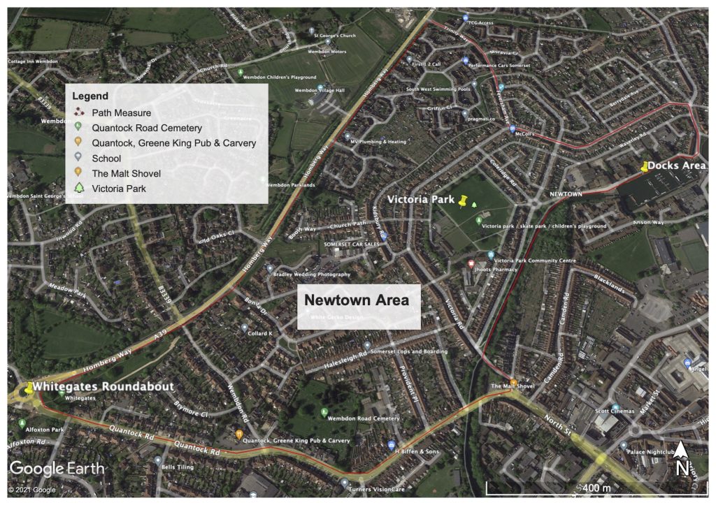
The cycling & walking infrastructure across Newtown area generally consists of quiet roads with some designated cycle paths, however there are a few dangerous road crossing areas. Therefore most routes have an ‘Infrastructure Risk Code’ of Amber or Green status with a few specific points in Red. The main difficulty in Newtown is finding the correct or ideal ‘Key Safe Routes’ across the area for accessing the town centre or to cycle further a field. The Newtown district sits beside the Docks and the start of the Bridgwater Canal, cycling and walking around the Docks and on the canal path is straight forward, but there are many hazards particularly for young riders. Newton is heavily populated with one main green space area- Victoria Park, there are a variety of reasonably safe routes across the district, but the main western corridor to town runs from; ‘old’ Wembdon Road, via the cycle path next to Wembdon Cemetary, through Halesleigh Road, on to Victoria Road (short cycle path), right and then left into Lyndale Avenue, veer right to the Docks area to access the River Parrett path and on to the town centre.
The main key routes are listed below, most will remain as is, however some improvement to routes, particularly unsafe focal points i.e. Kendale Road link River path, Kidsbury Road raised route, etc.

Newtown Key Safe Routes
- ‘Old’ Wembdon Road to the Docks (via Halesleigh Road) – Amber/Green
- Homberg Way to the Docks (via Victoria Park) – Amber/Green/Red
- Homberg Way to River Parrett path (via Trinity Way & Kendale Road) – Amber/Green/Red
- Docks link route to the town centre (via Brewery Field) – Amber/Green
Infrastructure risk coding ‘Red, Amber and Green’ explanation is given below……….
Infrastructure Risk Code (Red, Amber or Green)
The risk code is based around the five core design principles as laid out within the Local Transport Note (LTN 1/20), which are; Coherence (connectivity of route sections & junctions), Directness (shortest & safest route between places), Safety (design, peoples and a perceived safe passage), Comfort (both in street design and feel) & Attractiveness (off road, traffic free, good environment). The code though is primarily looking at both pedrestain & cyclist Safety.
Red: This code is stating that walkers & cyclists have no choice but to mix with either heavy or light traffic and/or vehicles will come close to the line that they are travelling. Route or part of the route section is dangerous, unsafe and accidents are a definite possibility.
Amber: This coding is aligned to the quiet areas of the town & surrounding villages. Although the users will generally feel safe on these route sections, there is still the possibility of minor accidents occurring and also that there will be a number of defined safety hazards.
Green: This route coding indicates that safe segregated or traffic free paths are available. These routes not only feel safe, but there is a definite separation of walker/cyclist from all kinds of traffic. It is noted that although junctions & crossings may be of a safe design and considered Green, they none-the-less have to be safely navigated by the user.
